Overview
With Google Map MCP, you can:
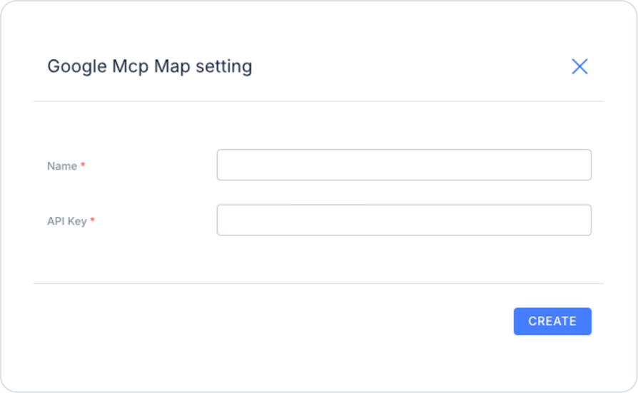
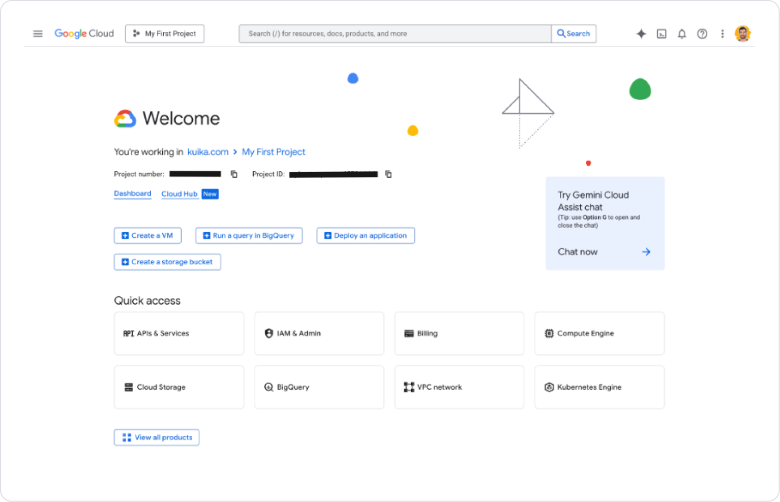
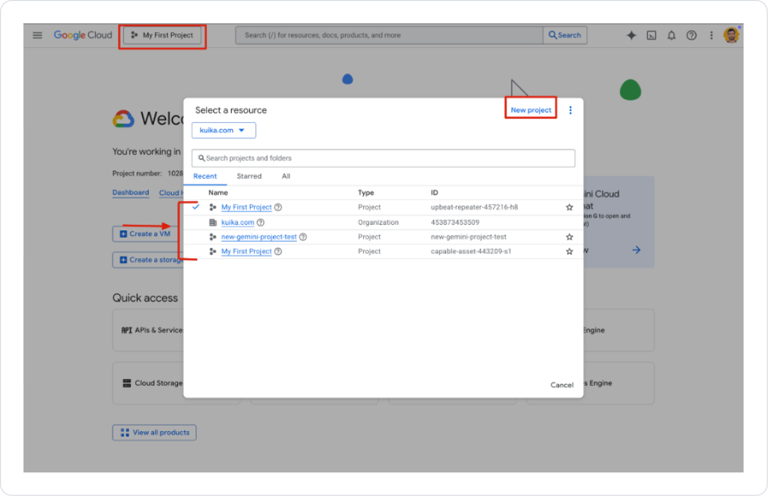
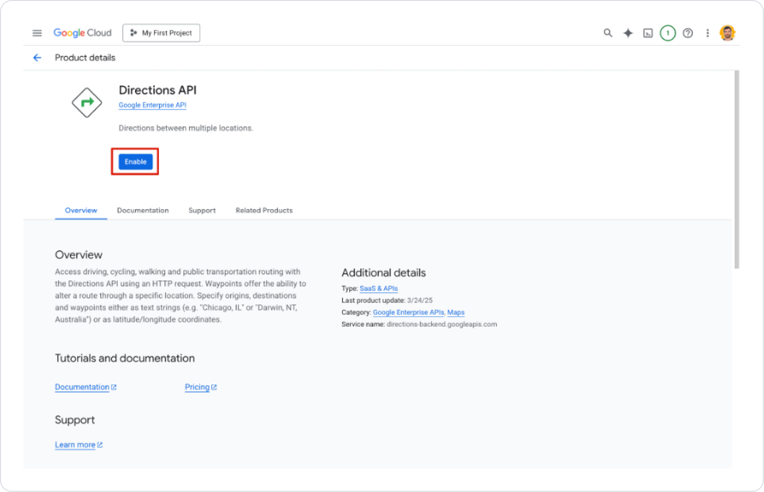
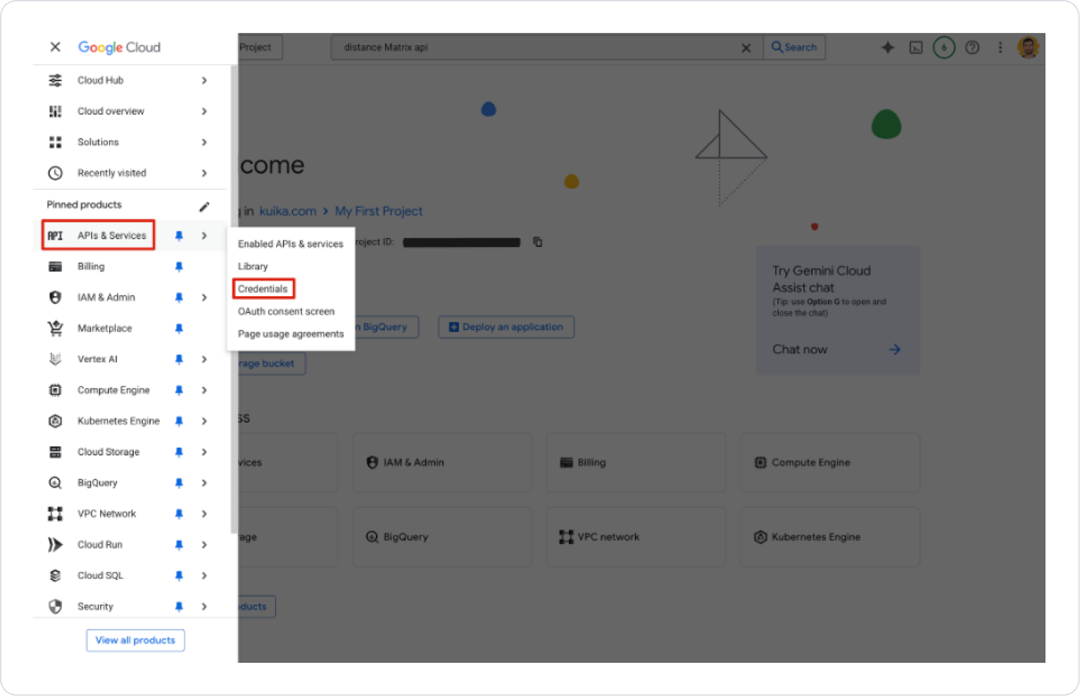
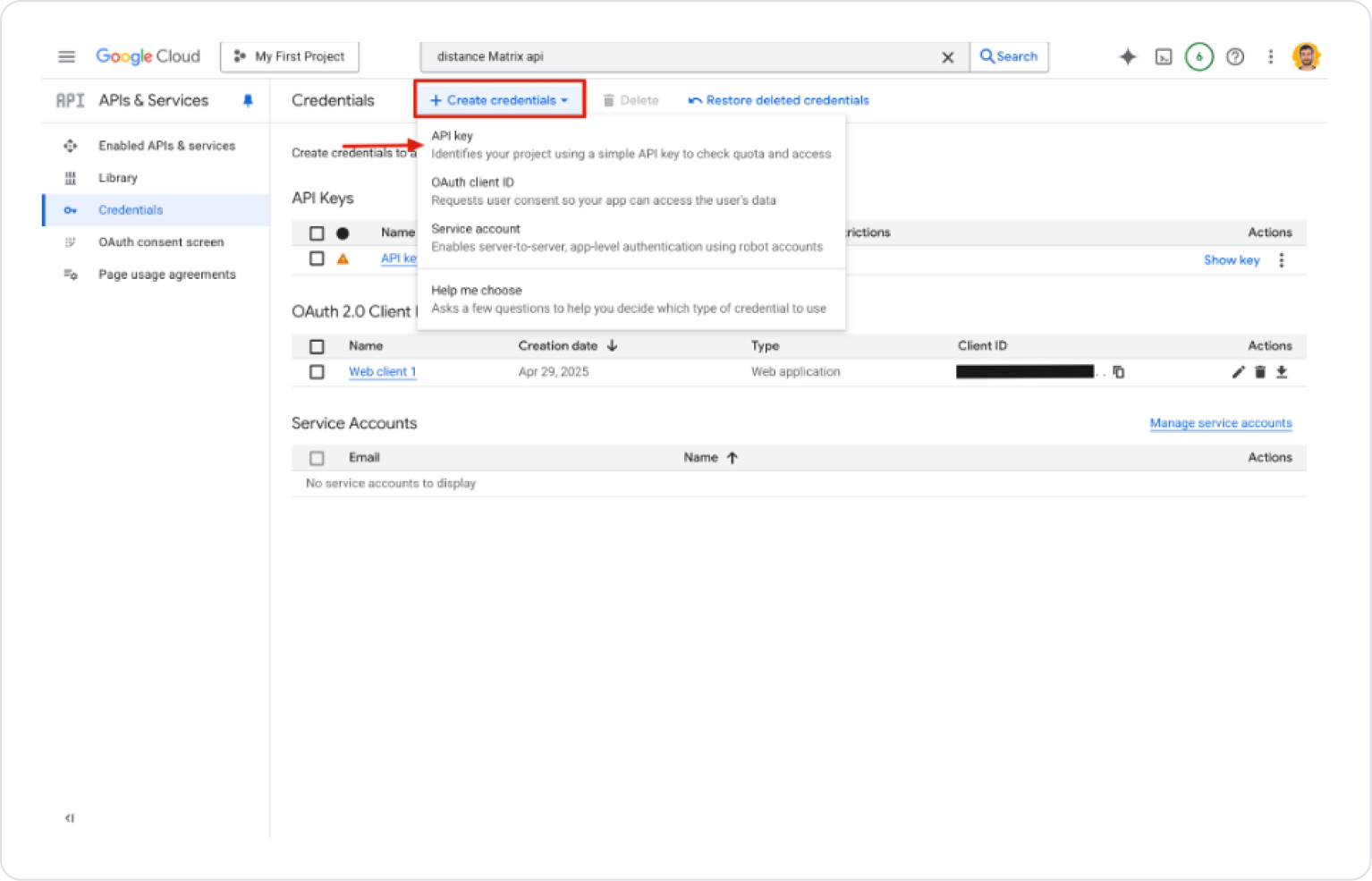
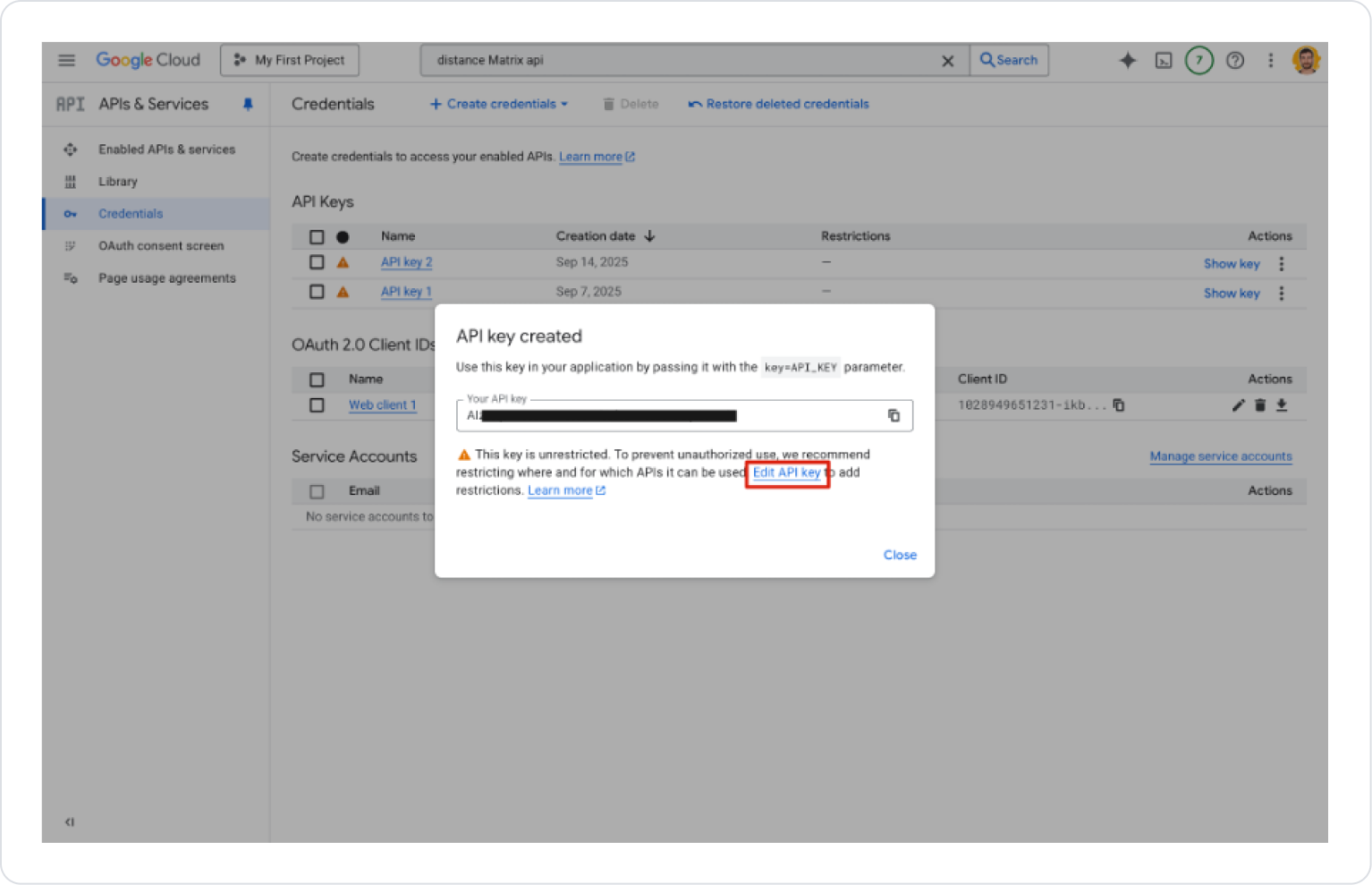
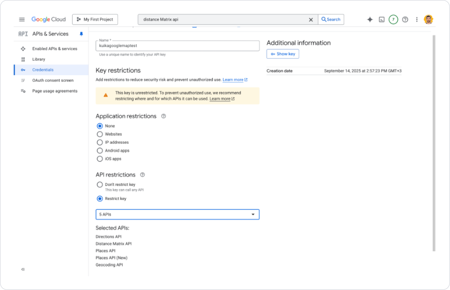
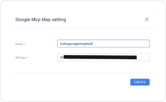
Convert an address to latitude-longitude coordinates (Geocoding) Convert coordinates to an address (Reverse Geocoding) Calculate routes (driving, walking, bicycling, transit)Search for places/locations in a specific area (Search Places)Calculate distance and time (Distance Matrix)Get place details (Place Detail) The Distance Matrix API is used in the background to calculate the distance and time of routes. The Google Map Directions action is used for route calculations in MCP. Configuration Manager Settings Log in to the Kuika platform. Select the project you want to work on. Go to the Configuration Manager → App Settings tab. Under MCP → Google Map , click ADD NEW. In the window that opens: Name : Name the setting.API Key : The key you obtained from Google Cloud Console. Creating a Google Map API Key Go to Google Cloud Console . Select an existing project or create a new one. From the menu, go to APIs & Services → Library . Enable the following APIs: Directions API Distance Matrix API Geocoding API Places API Places API (new) From the menu, go to APIs & Services → Credentials . Select Create Credentials → API Key . Copy the generated API Key . On the Edit API Key page: Application restrictions : For web → HTTP referrer (domain name) For mobile → Android package name / iOS bundle ID For server → IP restriction None → No restriction API restrictions : Only allow the APIs you enabled above.Save . Add the API Key to the Configuration Manager → Google Map Settings field in Kuika. Action Types
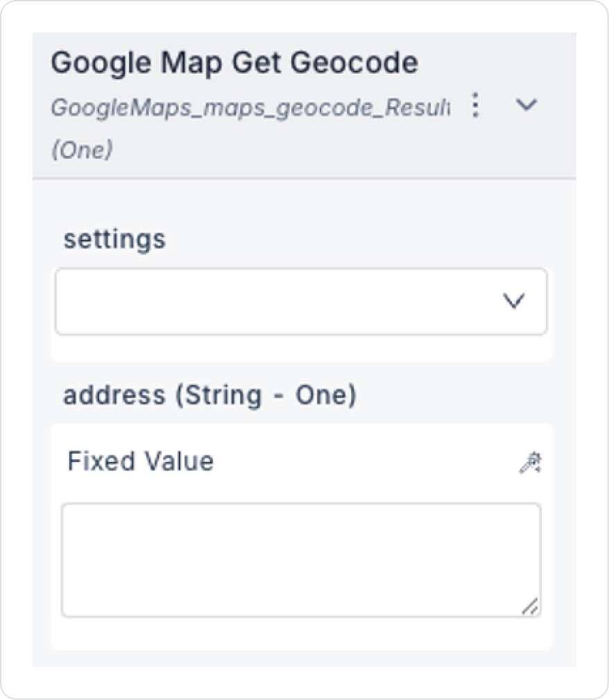
Google Map Get Geocode
Converts the address to coordinates.
Input:
settings: Select the Google Map setting created in Config Manager.address (String): Readable address entered by the user. (E.g.: “Istiklal Caddesi, Beyoğlu, İstanbul”)Output:
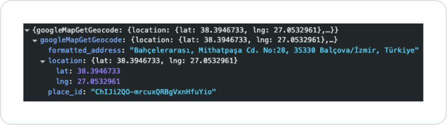
location.lat, location.lng: Latitude-longitude coordinates.formatted_address: Full address standardized by Google.place_id: Unique ID on Google Maps.Google Map Place Detail
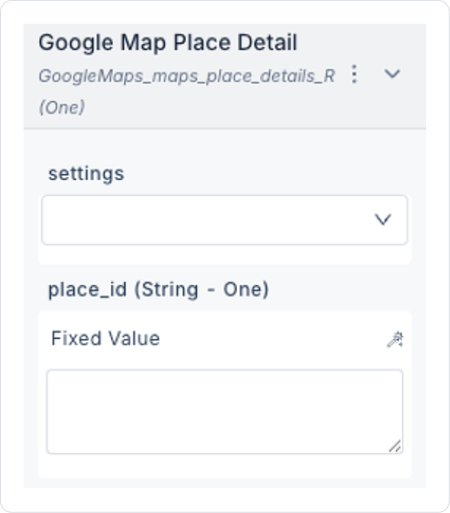
Retrieves details for a specific place_id.
Input:
settings: Select the Google Map setting created in Configuration Manager.place_id (String): The unique identifier of the place. (Obtained from Get Geocode or Search Places results.)Output:
name: Place/business name.location.lat, location.lng: Latitude-longitude coordinates.formatted_address: Standardized address.Google Map Reverse Geocode
Converts coordinates to an address.
Input:
settings: Select the Google Map setting created in Config Manager.latitude (Decimal): Latitude value.longitude (Decimal): Longitude value.Output:
formatted_address: Full address information.place_id: Unique identifier.address_components: Subcomponents of the address (street, city, country, postal code). long_name: Full description of the component.short_name: Standard abbreviation.types: Type of the component (e.g., route, locality, country).Google Map Search Places
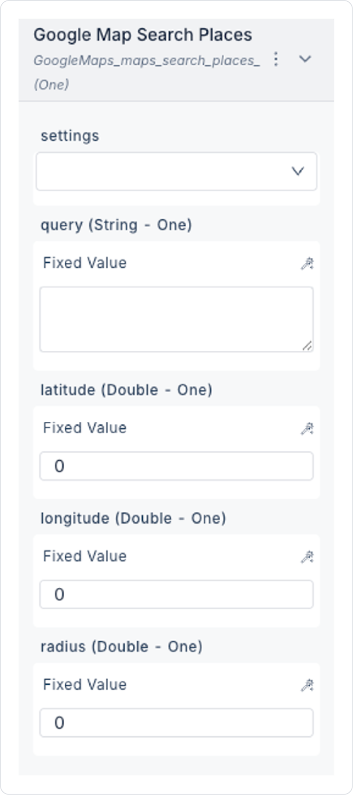
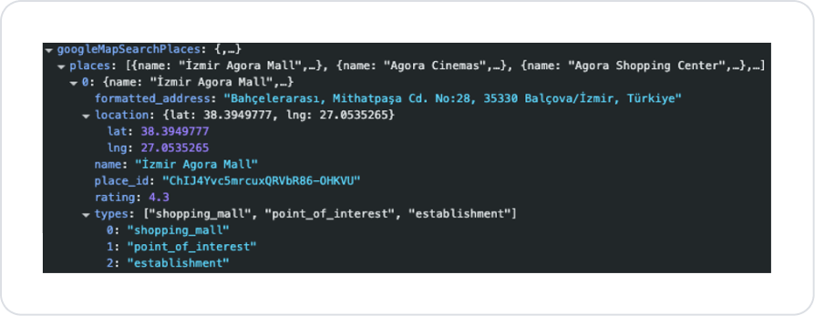
Searches for places in a specific area.
Input:
settings: Selects the Google Map setting created in Configuration Manager.query (String): Place name/category (e.g., “cafe,” “hotel”)radius (Integer): Maximum distance from the search center (in meters).latitude (Decimal): Latitude value.longitude (Decimal): Longitude value.Output:
name: Place name.formatted_address: Full address.location.lat, location.lng: Coordinates.place_id: Unique identifier.rating (Decimal): User rating (1.0–5.0).types: Categories (e.g., “restaurant,” “museum”).Google Map Directions
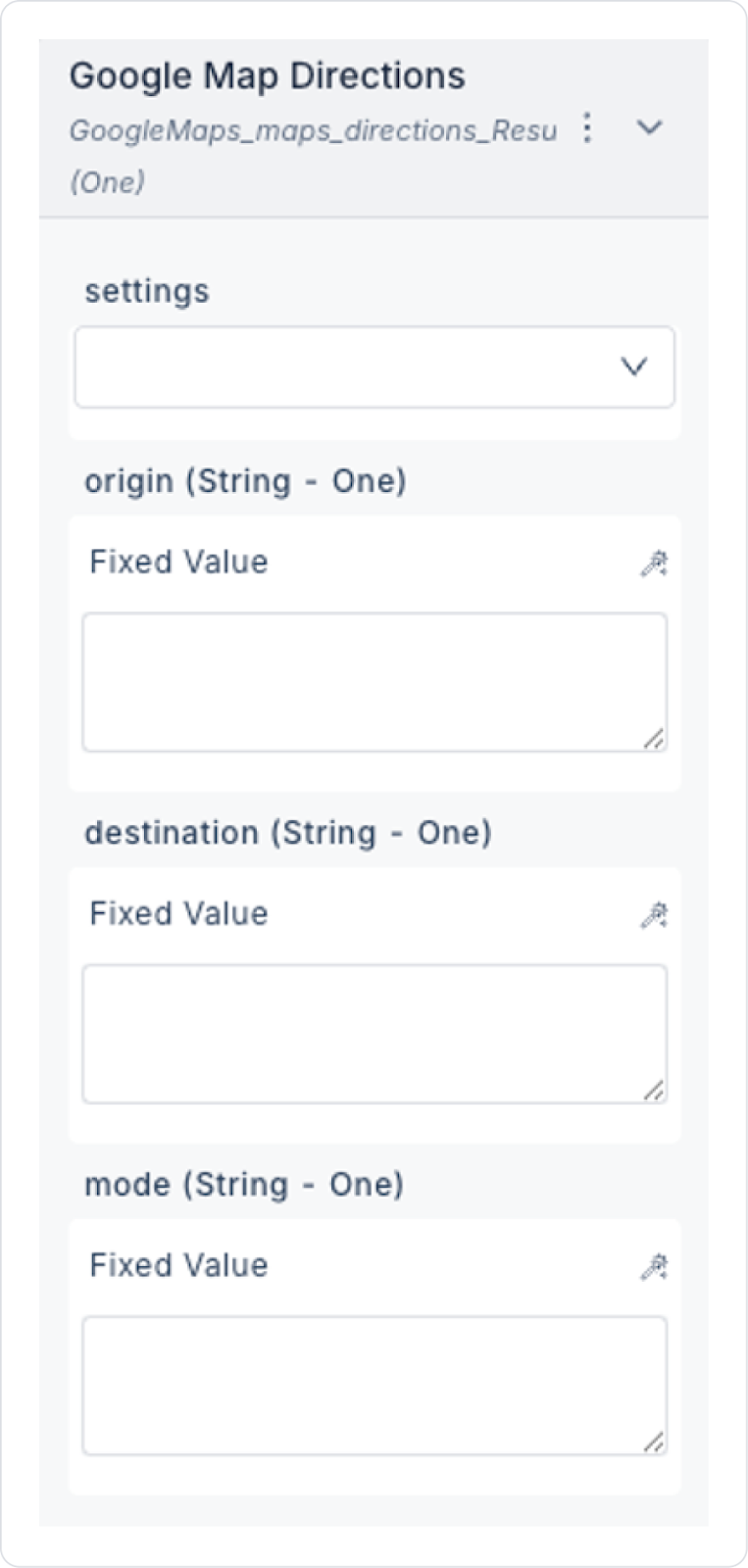
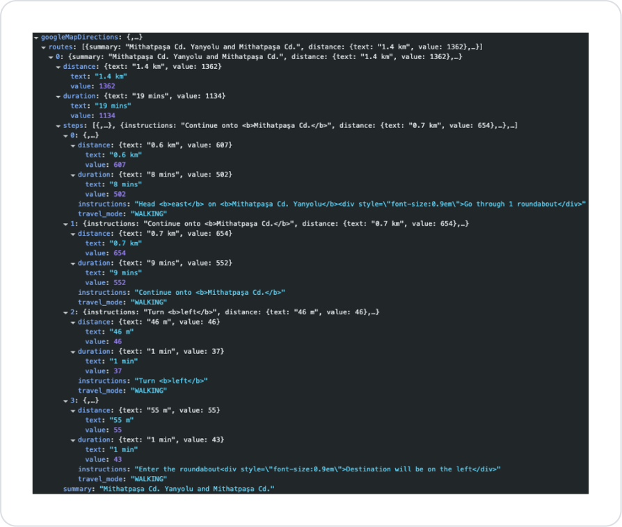
Calculates the distance and time between two points.
Input:
settings: Selects the Google Map setting created in Config Manager.origin (String/lat,lng): Starting point.destination (String/lat,lng): Destination.mode (String): Transportation mode. driving → By car walking → On foot bicycling → By bicycle transit → By public transportation Output:
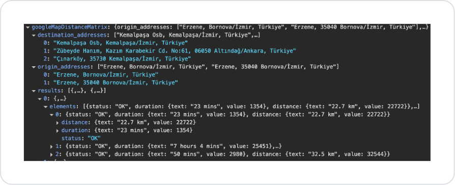
summary: General description of the route.distance.text / distance.value: Total distance (e.g., “14.3 km”, 14300).duration.text / duration.value: Estimated time (e.g., “20 mins”, 1200).steps: Detailed information for each step. instructions: HTML-formatted directions.travel_mode: Transportation mode used.Google Map Distance Matrix
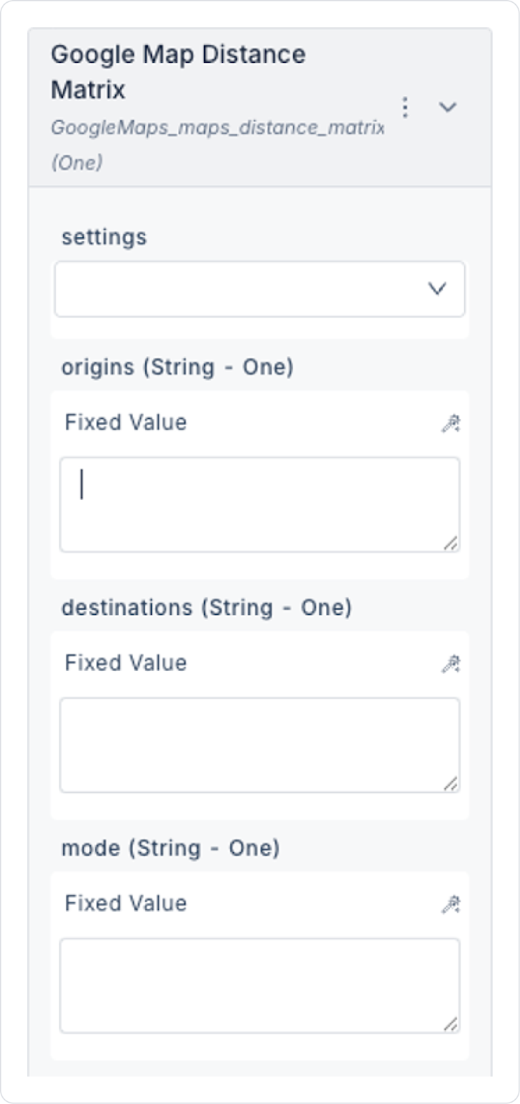
Input
settings: Select the Google Map setting created in Config Manager.origin (String/lat,lng): Starting point.destination (String/lat,lng): Destination point.mode (String): Transportation mode (driving, walking, bicycling, transit).Output
destination_addresses: Formatted destination addresses.origin_addresses: Formatted starting addresses.results: Details for each origin–destination combination. distance: Distance in text and meters.duration: Time in text and seconds.status: Result status (OK, ZERO_RESULTS, etc.).Usage Scenarios in Kuika
Get an address from the user and convert it to coordinates → Get Geocode Convert a point clicked on the map to an address → Reverse Geocode “Find cafes near me” → Search Places Show the fastest route between two addresses → Distance Matrix Get detailed route steps and directions between two points → Google Map Directions Get details about a place (e.g., rating, address) → Place Detail