Google Map Distance Matrix action is used to collect distance and time information between one or more starting points and one or more destination points in bulk. The user can obtain travel time and distance information via Google Maps by entering the origins and destinations parameters. It is frequently preferred in logistics, delivery planning, travel applications, and route optimization scenarios.
Technical Specifications
Function: Returns distance and duration information for multiple point combinations.
Parameters:
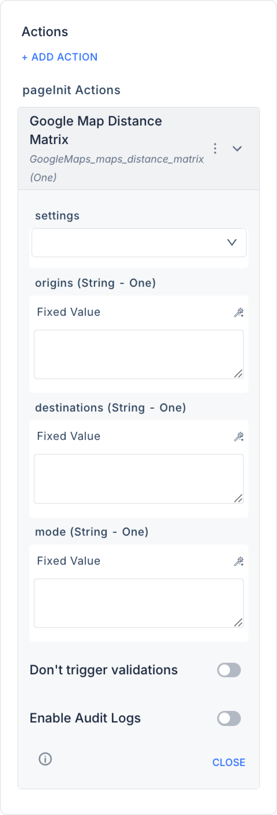
settings (Object – required): Connection settings required for Google Maps integration.
origins (String – Many, required): Starting points (address or coordinates).
destinations (String – Many, required): Destinations (address or coordinates).
mode (String – optional): Mode of transportation. Supported values:
“driving” → Vehicle
“walking” → Pedestrian
‘bicycling’ → Bicycle
“transit” → Public transportation
Result: Singular (One) → Returns distance and time for each origin and destination combination.
Value Binding:
Parameters can be entered as fixed.
Can be dynamically bound via form inputs or user selection.
Web & Mobile Support: Can be used in both web and mobile applications.
Google Map Distance Matrix Application Steps
1. Add Action
Open the screen where distance/time will be calculated in the Kuika project.
Add UI Design → + ADD ACTION → Google → Google Map Distance Matrix.
Enable Audit Log (Optional): Ensures that actions performed during execution are added to the audit log records. This allows you to track when changes were made to the system, by which user, and within the scope of which action.
Usage Scenario: “Delivery Time Calculation”
In a logistics application, delivery times from the warehouse address to different customer addresses need to be calculated.